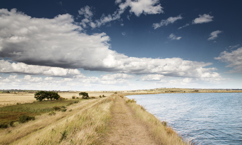
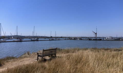
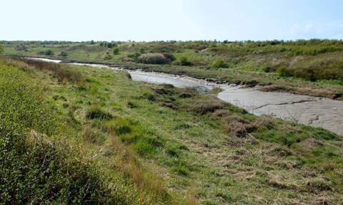
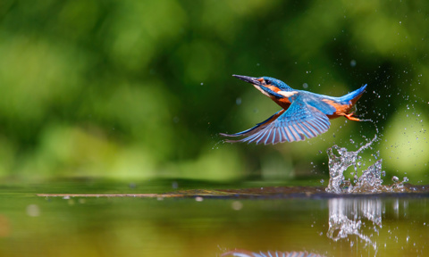
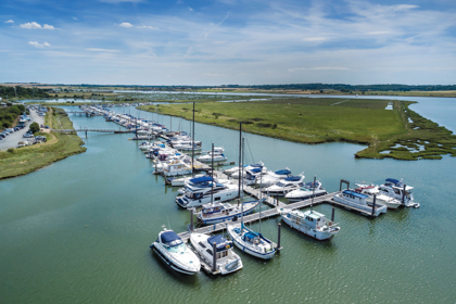
There’s plenty to explore in and around Fambridge Yacht Haven and for keen walkers and adventurers, you can discover some of the best scenic routes on foot.
Just dig out your walking shoes (or trainers!), pack a flask and a few snacks in your rucksack and prepare to be wowed by breath-taking scenery and stunning wildlife.
Here’s our guide to some of the best walks in and around North Fambridge...
- The Ferryman's Way, 10miles. Jump to this route
- South Woodham Parkrun Route, 3miles. Jump to this route
- The Dengie Peninsular Circular, 12miles. Jump to this route
- North Fambridge Circular, 6miles. Jump to this route
- River Roach / Paglesham, 9miles. Jump to this route
- BONUS ROUTE: Stow Maries, 7miles. Jump to this route

1. The Ferryman’s Way, 10miles
Start at Fambridge Yacht Haven/End in Burnham-on-Crouch
It seems apt to begin with a lovely walk from our very own Fambridge Yacht Haven, along the peaceful banks of the River Crouch. If you’re not already at the Yacht Haven, just follow signs to North Fambridge and keep going ‘til you reach The Ferry Boat Inn.
- Start at the Yacht Station at the end of Ferry Road and leave the clinking halyards behind as you head east, following the path along the riverbank.
- Continue alongside the Saltmarsh Coast Nature Reserve and take in the stunning estuaries and marshlands around. You could be mistaken for thinking you’re in a film set!
- Keep an eye out for a variety of unusual - but native to this area - birds and wildlife.
- Follow the winding trail along the riverbank passing through Althorne before arriving at Burnham-on-Crouch.
- Look out for its beautifully preserved windmill, a local landmark amongst other historic buildings and find the perfect spot for a refreshing drink and a bite to eat before catching a train or the bus back to Fambridge.

2. South Woodham Parkrun (SWF) Route, 3miles
Start at Marsh Farm Road
Like all “Parkruns” this free, friendly community event runs (!) weekly every Saturday @ 9am. So, unless you’re planning on participating, avoid that time of the week. Whether you opt to walk, run or ride (it’s flat) be prepared for a mix of terrain; from concrete paths to trails and grass.
Marsh Farm Country Park is a 300-acre park next to the River Crouch, a great place to explore on foot, with the dogs or by bike and enjoy the spectacular scenery and wildlife.
- Set off from the car park along the sea wall with the River Crouch to your right.
- After passing the SWF Yacht Club turn left towards the back of Marsh Farm until you reach a concrete path. Turn right, away from Marsh Farm.
- The concrete path then splits left/right with another footpath to the right. Take the foothpath to the right through the fields. Alternatively, continue on the concrete path to the right which continues around Clements Green Creek before taking the next right back towards the main river.
- If you took the footpath, turn right when you reach the main riverside footpath and that will lead you back towards your starting point.
- There is an optional extra loop if you're feeling good. Once back at your start point, continue along the riverside path to the right (westwards), and follow it to the right as the river splits into Fenn Creek. After 400, take the path alongside trees before rejoining Marsh Farm Road. Turn right back to your start point.

3. The Dengie Peninsula Circular Walk, 12miles
Start/Finish at St Nicholas Church, Tillingham
A quiet and flat walk, apart from a slight incline up onto the seawall. The Dengie National Nature Reserve is the area between the Blackwater and Crouch estuaries, with tidal mud flats and salt marshes, an important international Site of Special Scientific Interest (SSSI).
- From this 12th century Grade II listed church, head north through the churchyard and follow St Peter’s Way east along the edge of a field.
- The field turns to track, past a blue farmhouse and “Dots and Melons” farm.
- The footpath goes into a field so if it’s tricky you can follow the road around the outside.
- Look out for wind turbines to the north.
- You’ll come across South Sandbeach Meadows, another SSSI.
- Head towards the sea wall, with grass and farmland to the left and to the north the Chapel of St Peter on the Wall. Featured in our Top 10 historical sites around the River Crouch.
- Along St Peter’s Way you’ll find St Peter’s on the wall, supposedly the oldest surviving church in England.

4. North Fambridge Circular, 6miles
Start/finish at The Ferry Boat Inn, North Fambridge
If it’s quaint English villages, typical in this part of Essex, and beautiful wildflower meadows you’re after, then this is the walk for you. And at approx. 6 miles, it’s a lovely way to while away a few hours.
- From the village hall, set out through charming Essex countryside.
- You’ll walk across open meadows and winding footpaths through quaint villages, catching glimpses of thatched-roof cottages and welcoming village pubs.
- Check out our guide to the best waterfront pubs and eateries in and around the River Crouch to see where’s good to stop off for refreshments/food.
- Pause to soak up the lovely views at various designated viewpoints, before heading back to where you started.

5. River Roach / Paglesham, 9miles
Start/Finish at Paglesham Village
Slightly south east of North Fambridge, just inland from the River Roach is the village of Paglesham, with its white clapper-boards houses; characteristic of a nautical past.
It’s a good spot to start from if you plan to explore Paglesham Creek, the River Roach and the final resting place of HMS Beagle, the ship a well-known young graduate, Charles Darwin, travelled on to circumnavigate the world! HMS Beagle was reportedly used for King George IV’s coronation celebrations in 1821, gliding down the Thames and through old London Bridge.
From the village, head towards the sea and you’ll see 6 flat-as-pancake islands, separated by tidal creeks. This would have been a busy waterway for smugglers in years gone by and it still holds an air of mystery today.
- Start from outside the old Punch Bowl pub towards the head of Paglesham Creek, across the fields. Look out for the line of equidistant trees to the east.
- Along the creek, you’ll spot washed up boats and on the other side Wallasea Island, an RSPB nature reserve.
- The creek feeds into the River Roach, where you’ll find relics, wrecks and remnants of a wartime age (pillbox’s).
- Beyond the abandoned wrecks and old oyster beds the river bends inland and the mud supposedly hides the infamous HMS Beagle; near to where it was originally moored.
- Follow the River Roach west and turn inwards after another pillbox, past Bartonhall Creek in the direction of Stannets Creek.
- If you miss the unmarked path leading back into Paglesham village, there’s a muddy path towards South Hall Farm and a short roadside section to East Hall, then a final stomp across fields back to the old pub. Check out our list of nearby pubs and eateries here.

BONUS ROUTE: Stow Maries Aerodrome Walk, 7miles
Start/Finish in Stow Maries village
As a thank you for reading this far, here’s a bonus route but you’ll need to head inland.
The quaint hamlets of Stow Maries, Cold Norton and Purleigh sit between North Fambridge and Maldon, nestled in our lush Essex landscape. Hidden among the gently rolling hills, you'll find Stow Maries Great War Aerodrome; the birthplace for Britain's air defence following the London bombings in World War 1.
- From Stow Maries head eastwards through the quiet field footpaths towards Cold Norton.
- Passing through Cold Norton, cross the road heading north to the village of Purleigh, passing England's first vineyards, New Hall.
- Turn left in Purleigh, almost back on yourself, towards Howegreen and along the edge of several fields before arriving at the entrance to Stow Maries Aerodrome. The Aerodrome is open for 10 months a year and well worth a visit. Either go through the Aerodrome (you’ll need pay the entrance fee), or head south on the road 200m before turning right to walk on the footpath around the site.
- Turn left to head south, passing the Aerodrome outbuildings, and through fields back to Woodham Road before turning left back into Stow Maries.

Practical Advice for Walking Explorers
Remember when you’re setting out on a walk, go prepared:
- The weather in North Fambridge can be unpredictable, so remember to check the forecast before setting off. You can even check our local webcams!
- Dress appropriately for the conditions. Layers you can add or remove (and not too heavy to carry) are useful.
- Pack a waterproof jacket and sturdy footwear, especially if you’re adventuring around more challenging routes.
- Take a rucksack with some day-to-day essentials; water, sun cream, snacks, a map or guidebook, and a first aid kit.
- Top tip if you’re walking solo: make sure you tell someone where you're going and when you expect to return.
- Please stay on designated paths, follow signs, and adhere to any wildlife warnings.
- Keep your eyes peeled for some spectacular wildlife but do keep a safe distance and above all, avoid disturbing or feeding them.
Map
It’s up to all of us to help protect and preserve our ecosystem, so when you’re exploring please look out for signs warning of nesting birds, keep your dog on a lead and tread carefully. That way, you’ll see the best North Fambridge has to offer.
We hope you enjoy your walking adventures! Please share stories and pictures with us and get in touch if you’d like us to add other routes to the list.
Happy exploring!
Routes on this map are for reference only and routes plotted on these maps may not be to scale.

